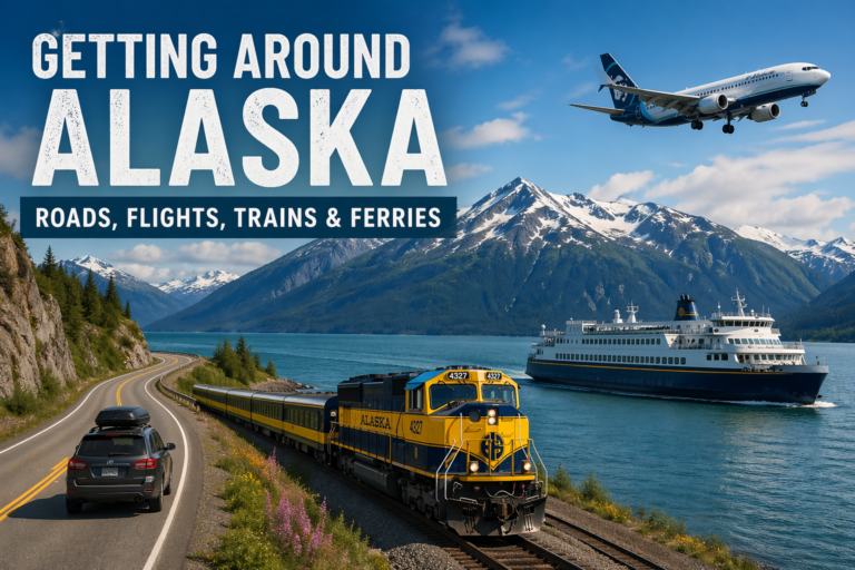
Getting Around Alaska: Roads, Flights, Trains & Ferries
Getting Around Alaska
Getting around Alaska is not like traveling in most states. Distances are bigger than they look, and you can’t drive everywhere. Most trips use a mix of driving, flying, trains, and ferries, and knowing how each works helps you plan something that actually works.
Can You Drive Everywhere in Alaska
No. Large parts of Alaska are not connected by roads, and many western and northern communities are only reachable by plane or boat. If you’re planning a road trip, you’ll be staying mostly in Southcentral and Interior Alaska.
Driving in Alaska
Driving is the easiest way to explore the main road system because it gives you flexibility and the ability to stop when you want. But it’s not a normal road trip. Expect long stretches between towns, limited gas in some areas, and slower travel than you think. What looks close on a map can take hours, so give yourself extra time and don’t try to cram too much into one trip.
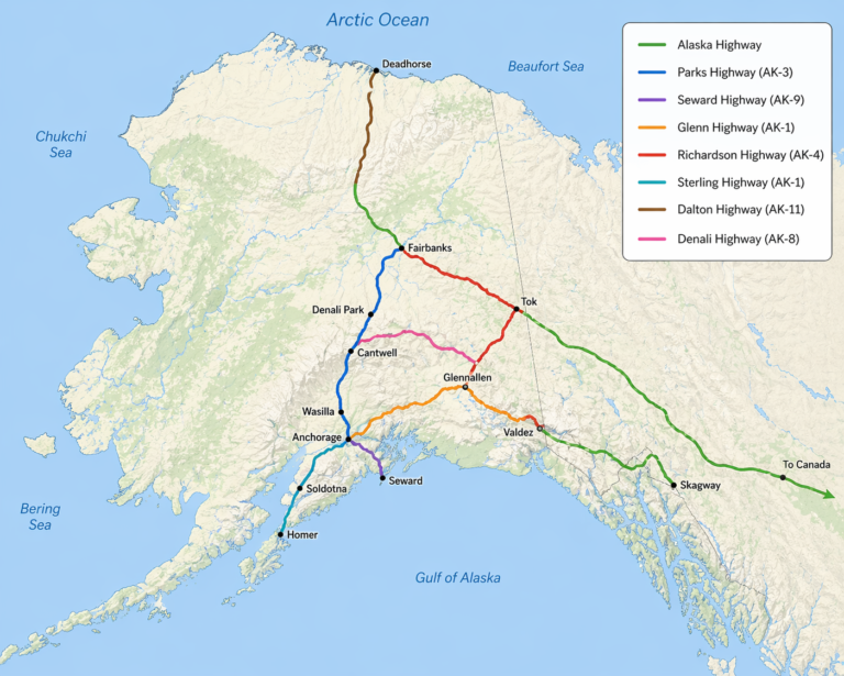
Major Highways in Alaska
These are the main routes most travelers use:
Alaska Highway (red)
The main route into Alaska from Canada and the Lower 48. This is the highway you’ll use if you’re driving up to the state.
Parks Highway (AK-3) (blue)
Runs between Anchorage and Fairbanks. This is the primary route to Denali National Park and one of the most traveled highways in Alaska.
Seward Highway (AK-9) (green)
Connects Anchorage to Seward. Known for coastal views, mountains, and frequent wildlife sightings along the Turnagain Arm.
Glenn Highway (AK-1) (orange)
Runs from Anchorage to Glennallen. This route connects you toward Valdez and eastern Alaska and offers views of the Chugach Mountains.
Richardson Highway (AK-4) (purple)
Connects Valdez to Fairbanks. One of the oldest roads in Alaska and a major north to south route through the Interior.
Sterling Highway (AK-1) (teal)
Branches off into the Kenai Peninsula. This is the main route to Soldotna, Kenai, and Homer.
Dalton Highway (AK-11) (brown)
Runs north from Fairbanks to Prudhoe Bay. Remote, mostly gravel, and used primarily for industrial travel. Not part of most visitor itineraries.
Denali Highway (AK-8) (yellow)
Connects Paxson to Cantwell. A scenic, mostly gravel road best traveled in summer and known for wide open views and fewer crowds.
Flying in Alaska
Flying is the only way to reach many parts of the state. Major cities are connected by regular flights, while smaller communities rely on regional planes and bush flights. Flying saves time but can get expensive, especially during the summer travel season.
Alaska Railroad
The Alaska Railroad runs between Anchorage, Talkeetna, Denali, and Fairbanks. It’s slower than driving, but the views are better and the experience is more relaxed. It works well if you want to enjoy the journey instead of rushing between stops.
Ferries in Alaska
Ferries are mostly used in Southeast Alaska and connect places like Juneau, Sitka, and Ketchikan. They can also carry vehicles, which makes them useful for longer trips. Schedules are more limited than road travel, so planning ahead is important.
Other Options
Rental cars, shuttles, guided tours, and water taxis are common in popular areas. In more remote regions, options are limited and transportation becomes less predictable.
What to Expect
You can’t see everything in one trip – I have lived here my whole life and still haven’t seen everything. Travel takes longer than expected, and weather can delay flights or change plans. Building extra time into your itinerary and staying flexible will make the trip smoother.
Most trips use a mix of driving and one other method like flying or the train. Planning around real distances instead of what looks close on a map is what makes the difference between a smooth trip and a stressful one.